Projecten

De onderzoeksprojecten die de dienst Seismologie-Gravimetrie van de Koninklijke Sterrenwacht van België uitvoert of coördineert, vaak samen met universiteiten en andere wetenschappelijke instellingen.

12 projectenBeschrijvingen in het Engels.

  1. 2021–2023

    SEISMOSTORM

    The SEISMOSTORM project aims to make the ROB's analog seismic data openly available to the seismological community following the community-defined storing standards for digital seismic data. This will be achieved by developing image processing and machine learning methodologies to digitize the waveforms from scanned seismograms and transform them into calibrated and time-coded seismic time series.

    Team
    T. Lecocq (ROB)
    • Analog Seismograms
    • Archives
    • Machine Learning
    • FAIR data
    • Open Data

    Lees de voorstelling

  2. 2020–2024

    GEOCAMB

    GEOCAMB is a four year BELSPO funded-project (project nr: NR B2/191/P1/GEOCAMB) granted after the Pilar 1 BRAIN.be 2.0 call in 2019. The GEOCAMB consortium consists of several federal institutions and universities. This project aims to evaluate the demand for geothermal energy to heat public buildings and to investigate the geothermal potential of the Cambrian bedrock, present below the Flemish and Walloon Brabant provinces and the Brussels region.

    Team
    K. Van Noten (ROB)
    • Geothermal Energy
    • Geophysics
    • Near Surface
    • Ambient Noise

    Lees de voorstelling

  3. 2020–2025

    FAULTCOLLAB

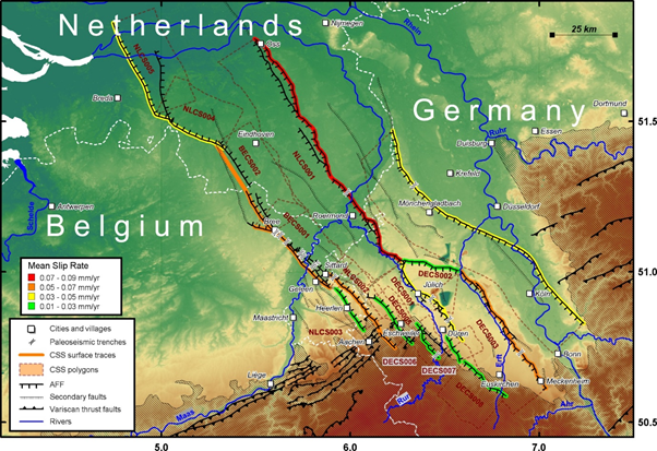
    FAULTCOLLAB is a research project in earthquake geology and tectonic geomorphology of active faults in intraplate context between the Seismology-Gravimetry Department of the Royal Observatory of Belgium (ROB) and the Unit of Physical Geography and Quaternary of ULiège (UGPQ) in the frame of the FED-tWIN programme of the Belgian Science Policy Office (BELSPO).

    Team
    M. Lefevre (ROB/ULiège), K. Vanneste (ROB), A. Demoulin (ULiège), A. Hubert-Ferrari (ULiège)
    • Active faulting
    • Tectonic geomorphology
    • Paleoseismology
    • Quaternary geology
    • Near-surface geophysics

    Lees de voorstelling

  4. 2020–2024

    LASUGEO

    Monitoring Land Subsidence caused by Groundwater exploitation through gEOdetic measurements (LASUGEO). Groundwater is a hidden resource, which is quantitatively much more significant than surface waters. Their exploitation and the impacts at the surface created by groundwater withdrawals essentially for human (drinking water) and industrial needs are generally difficult to estimate, monitor and plan. It is difficult to adequately locate and quantitatively appreciate surface impacts, resulting in a lack of awareness and/or evidence regarding the extent of risks and pressures facing the growing groundwater needs. The main objectives of the LASUGEO project are associated to the groundwater exploitation that has hitherto provoked unforeseen land surface movements (subsidence sometimes followed by a non-elastic rebound during the aquifer recharge).

    Team
    X. Devleeschouwer (RBINS), M. Van Camp (ROB), K. Walraevens (UGent), A. Dassargues (ULiège)
    • Ground Water
    • Subsidence
    • Geodesy

    Lees de voorstelling

  5. 2019–2023

    EPOS-BE

    The EPOS-BE project is a four year BELSPO-funded project (project nr: FSIRI/33/EP1) and was created as Belgium's contribution to the European Plate Observing System (EPOS). Under this umbrella, the projected long-term plan aims to combine forces of various research infrastructures of different Earth Science institutes from all over Europe. The idea is to unify data products and combine data infrastructures, enabling much faster and easier multilateral data exchange. One of the goals of the Royal Observatory of Belgium is to contribute to EPOS as a GNSS and seismic data provider.

    Team
    M. Van Camp, K. Van Noten, M. Zeckra, T. Lecocq
    • Site Characterization
    • Ambient Noise

    Lees de voorstelling

  6. 2018–2021

    ISNoise

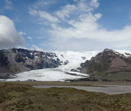
    The IS-Noise project aims at studying the applicability of seismic noise-based techniques for monitoring different targets in Iceland: volcanoes, geothermal areas and fault zones.

    Team
    Kristín Jónsdóttir, Thomas Lecocq
    • Ambient Noise
    • Monitoring

    Website van het project

  7. 2017–2019

    LARGE MEM

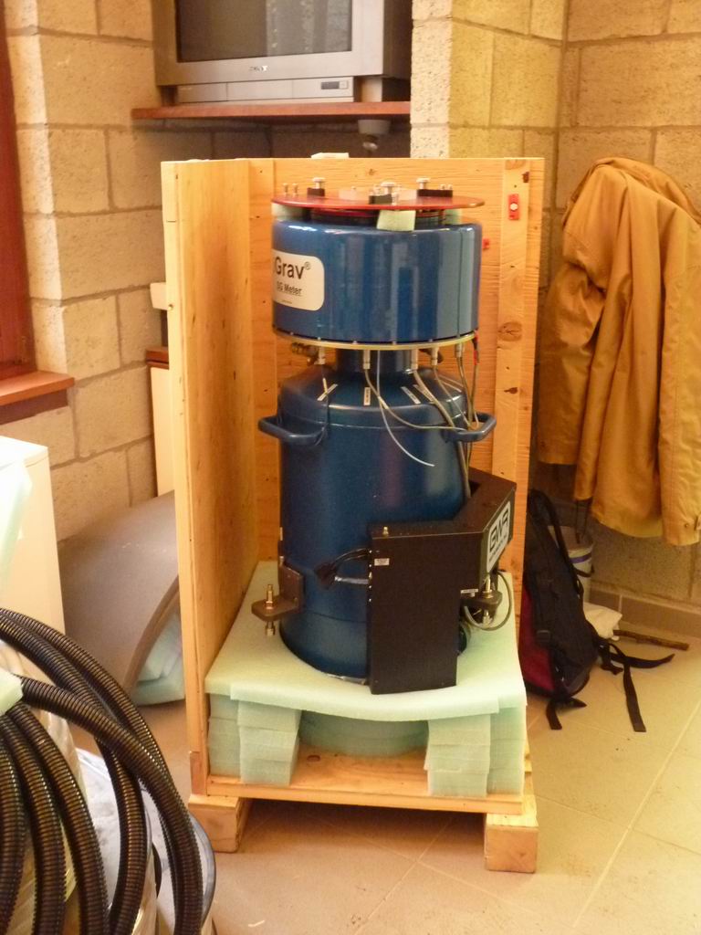
    The LARGE-MEM project is a small-scale but dense noise-based study aiming at better understanding rainfall and groundwater storage effects on seismic velocities measured by a dense seismic network. The goal of LARGE-MEM is to demonstrate that the actual quantity and location of water in the subsurface can be estimated from measurements using a LargeN array. To achieve this, the data from superconducting and absolute gravimeters located in a gallery under the study site will be used to measure precisely the mass of water sampled by the seismic waves.

    Team
    Thomas Lecocq
    • Ambient Noise
    • Imaging
    • Monitoring

    Lees de voorstelling

  8. 2011

    AcceleROBPreparing for the big one(s)

    The AcceleROB project aims at deploying 90 low-cost accelerometric stations in Belgium in order to measure the real ground motion whenever a larger-than-usual earthquake will strike. "AcceleROB" is an acronym for "Accelerometric station of the Royal Observatory of Belgium" (Seismology-Gravimetry service). A complete AcceleROB includes: a RaspberryPi microcomputer, a power supply, a network cable, a JoyWarrior Accelerometer and a tripod brick (a clean one, not like on the picture at the right!). This setup allows installing the sensor in basements without the need to leave a computer permanently switched on. The station is low-consumption: less than 3 Watts (7 W with the Devolo) and low-bandwidth: around 365 bytes per second (30MB/day)!

    Team
    Dr. Thomas Lecocq, Giovanni Rapagnani, Baudouin Bukasa, Dr. Thierry Camelbeeck
    • Accelerometer
    • Ground Motions
    • Instrument

    Lees de voorstelling

  9. 2013

    KARAGKarst Aquifer Research by Geophysics

    Karst Aquifer ReseArch by Geophysics (KARAG) project is a research project resulting from the collaboration of 3 belgian institutes (University of Namur, University of Mons and Royal observatory of Belgium), and U. Luxembourg. This 4 years project that started in July 2013 is supported by the Fund for Scientific Research – FNRS from the Wallonia-Brussels Federation.

    Team
    Michel Van Camp, Prof. Vincent Hallet, Prof. Olivier Kaufmann, Prof. Yves Quinif, Prof. Olivier Francis, Arnaud Watlet
    • Hydrogeology

    Website van het project

  10. 1996–2016

    SAFE Project

    Paleoseismologic trench study of the Geleen fault in Rotem and the Rauw fault in Mol (Belgium).

    Team
    Dr. Kris Vanneste, Koen Verbeeck, Dr. Thierry Camelbeeck
    • Paleoseimology
  11. 2005–2009

    Seismic CycleMarie Curie Excellence Grant

    Why do large earthquakes not always occur at regular time interval on a given fault? Present-day physical models on repeating ruptures are poorly constrained and can yield inconsistent predictions. To be able to anticipate future seismic catastrophe, we need to measure and understand the irregularities in the seismic cycle.

    Team
    Aurélia Hubert-Ferrari, Xavier Boës, Jeff Fraser, Ulas Avsar
    • Seismic cycles