KOBERN-GONDORF (DE) - 2012-03-12 19:00:42
- Magnitude 2.4
Last update : 2012-04-27 16:39:30 Belgian time
Main parameters
| Date and time |
2012-03-12 19:00:42 UTC
2012-03-12 20:00:42 Belgian time |
| Type | Earthquake |
| Magnitude | ML 2.4 |
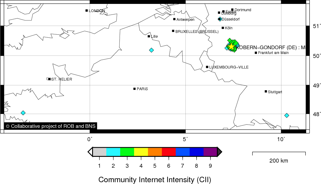
| Region | KOBERN-GONDORF (DE) |
| Epicentral coordinates | 50.306° N, 7.399° E Uncertainty ± 3.1 km |
| Depth of hypocenter | 10.0 ± 3.1 km |
Data source : ROB (Royal Observatory of Belgium)
Location map
Quake measurements
Measurements by the Belgian seismic network
| Station | Epicentral distance (km) |
P-Wave arrival (hh:mm:ss.ss) | S-Wave arrival (hh:mm:ss.ss) | Maximal ground displacement (nm) |
|
|---|---|---|---|---|---|
| Code | Place | ||||
| VIA | VIANDEN | 95 | 19:00:57.90 | 19:01:10.46 | - |
| KLB | KALBORN | 95 | 19:00:58.15 | 19:01:08.79 | 87.4 |
| MEMS | MEMBACH | 104 | 19:00:59.82 | 19:01:13.17 | 55.6 |
| WLF | WALFERDANGE | 114 | 19:01:00.62 | 19:01:14.72 | 62.2 |
| HRK | HERKENBOSCH | 131 | 19:01:04.04 | 19:01:19.22 | - |
| STI | SART TILMAN | 134 | 19:01:04.23 | - | - |
| EBN | EBEN-EMAEL | 134 | 19:01:04.24 | 19:01:18.78 | - |
| CLA | CLAVIER | 149 | 19:01:06.41 | 19:01:23.73 | 32.1 |
| RCH | ROCHEFORT | 156 | 19:01:07.33 | 19:01:25.79 | - |
| GES | GESVES | 164 | 19:01:08.19 | 19:01:25.63 | - |
| MRD | MAREDSOUS | 187 | 19:01:11.36 | 19:01:34.79 | - |
| DOU | DOURBES | 201 | 19:01:12.98 | 19:01:38.30 | 29.7 |
| SKQ | STEENKERQUE | 238 | 19:01:19.96 | - | - |
Macroseismic
Data
| Total number of responses | 63 |
|---|---|
| Intensity I | 13 |
| Intensity II | 16 |
| Intensity III | 32 |
| Intensity IV | 2 |
Attention! The intensities derived from the macroseismic enquiry are raw unverified data.
Map
Data policy
Please read on this notice to learn more about our data policy.